Your cart is currently empty!
Sale!


Garmin Inreach Explorer
KSh 56,000.00
Handheld Satellite Communicators with GPS Navigation Rugged handheld satellite communicators enable two-way text messaging via 100% global Iridium® satellite network (satellite subscription required) Trigger an interactive SOS to the 24/7 search and rescue monitoring center Track and share your location with family and friends Pair with compatible mobile devices using the free Earthmate® app for…
Description
DIMENSION 2.7″ x 6.5″ x 1.5″ (6.8 x 16.4 x 3.8 cm) with keypad and SOS door bump
DISPLAY SIZE 1.4″W x 1.9″H (3.5 x 4.7 cm); 2.31″ diag (5.9 cm)
DISPLAY RESOLUTION 200 x 265 pixels
DISPLAY TYPE transflective color TFT
WEIGHT
7.5 oz (213.0 g)
WATERPROOF IPX7
BATTERY TYPE Rechargeable internal lithium-ion
BATTERY LIFE
Up to 100 hours at 10-minute tracking mode (default)
Up to 75 hours at 10-minute tracking with 1-second logging
Up to 30 days at the 30-minute interval power save mode
Up to 3 years when powered off
INTERFACE micro USB
MEMORY/HISTORY 2 GB (user space varies based on included mapping)
Maps & Memory
PRELOADED MAPS
yes. The North America SKU of the inReach Explorer+ comes preloaded with a 1:24k map of Garmin Yarmouth (Former DeLorme) North America data of the U.S. and Canada. Mexico also is included at a 1:125k scale (derived from Garmin Yarmouth’s Digital Atlas of the Earth).
ABILITY TO ADD MAPS
BASEMAP
INCLUDES DETAILED HYDROGRAPHIC FEATURES (COASTLINES, LAKE/RIVER SHORELINES, WETLANDS AND PERENNIAL AND SEASONAL STREAMS)
DISPLAYS NATIONAL, STATE AND LOCAL PARKS, FORESTS, AND WILDERNESS AREAS
WAYPOINTS/FAVORITES/LOCATIONS 500
TRACKS single dynamic track
NAVIGATION TRACK LOG single auto overwrite track log
NAVIGATION ROUTES 20, 200 points per route
Sensors
HIGH-SENSITIVITY RECEIVER
GPS
BAROMETRIC ALTIMETER
COMPASS Yes (tilt-compensated 3-axis)
GPS COMPASS (WHILE MOVING)
inReach® Features
INTERACTIVE SOS
SEND AND RECEIVE TEXT MESSAGES TO SMS AND EMAIL
SEND AND RECEIVE TEXT MESSAGES TO OTHER INREACH DEVICE
EXCHANGE LOCATIONS WITH OTHER INREACH DEVICE
MAPSHARE COMPATIBLE WITH TRACKING
VIRTUAL KEYBOARD FOR CUSTOM MESSAGING
SEND WAYPOINTS TO MAPSHARE DURING TRIP
SEND ROUTE SELECTION TO MAPSHARE DURING TRIP
Outdoor Applications
COMPATIBLE WITH EARTHMATE
GARMIN EXPLORE WEBSITE COMPATIBLE
Connections
CONNECTIONS WIRELESS CONNECTIVITY
yes (BLUETOOTH®)
Related products
-
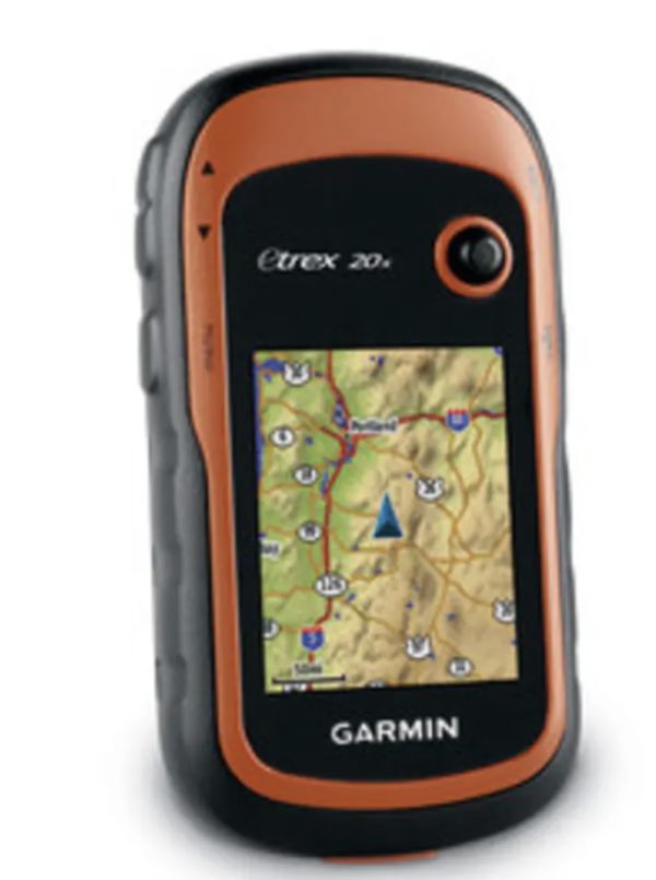
Garmin eTrex 20x
-
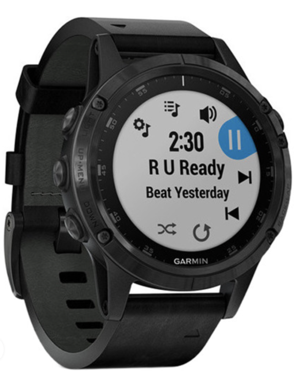
Garmin fenix 5 X Plus GPS Watch
-
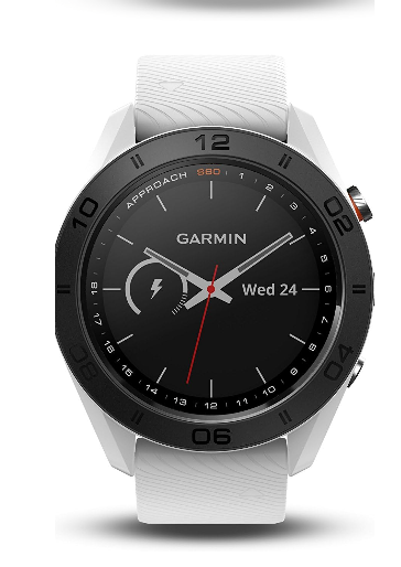
Garmin Approach S60
KSh 53,500.00 -

Vivomove Style
KSh 38,700.00 -
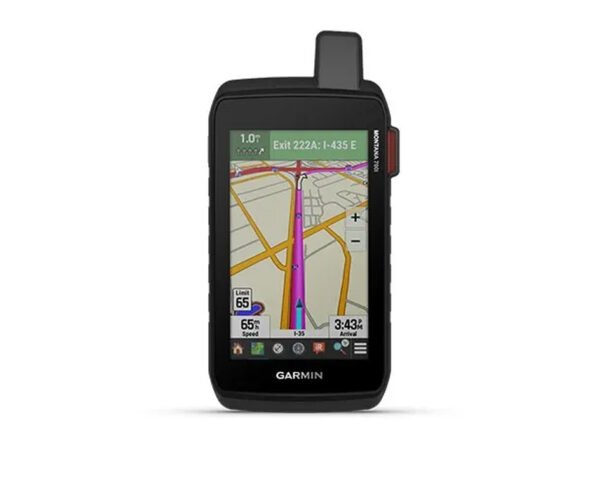
Montana 700i
KSh 72,500.00
Reviews
There are no reviews yet.